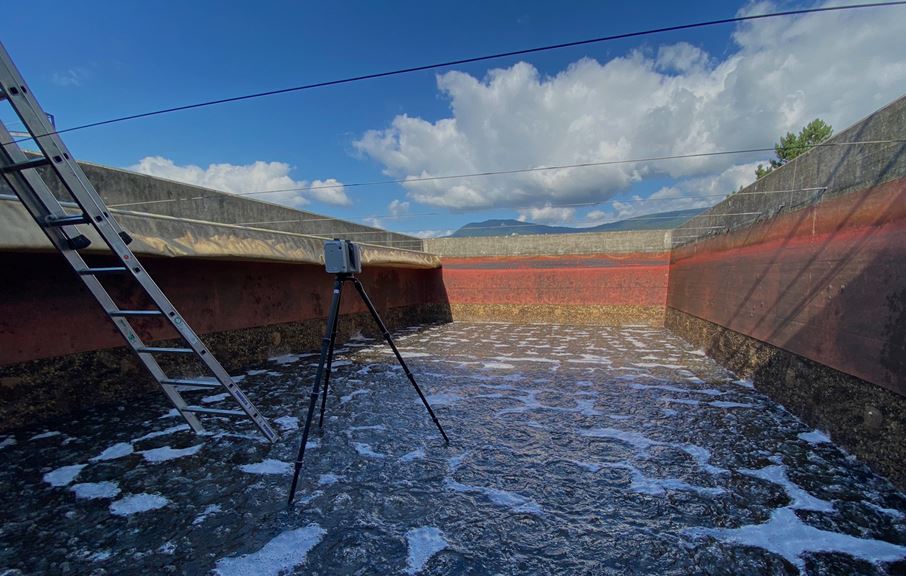
A laserscan, also known as laser scanning, is a three-dimensional measurement technique that allows for the precise measurement of the geometry of structures.
The laserscan involves emitting a pulsed laser beam and measuring the time it takes for the beam to bounce off surrounding objects and return to the sensor. Using these flight times, the sensor can determine the distance of the object, as well as its relative position and orientation with respect to the sensor.
By sweeping the laser beam in a horizontal plane, the sensor can measure distances and angles in all directions around the sensor.
These measurements are used to create a point cloud. Each point represents the three-dimensional position of a very small portion of the scanned scene.
Point clouds are often very dense, with millions of points in a single cloud, and can be visualized as grayscale or color images, where color can represent additional properties such as sensor signal intensity, surface reflectivity, or other features.
Points are defined by their x, y, and z coordinates, which represent their position in a Cartesian coordinate system. The coordinate system is therefore local or relative. It is also possible to georeference the cloud to link points to precise spatial coordinates in a geographic reference system. This allows for accurate mapping of geospatial data and integration with other georeferenced data in a geographic information system (GIS).
A point cloud is a rich 3D data source that can be used for various applications:
- 3D modeling: create digital surface models of complex shapes, such as buildings, landscapes, or industrial objects.
- Mapping: Point clouds can be used to generate accurate 3D maps for city management, natural environment mapping, and industrial site monitoring.
- Shape analysis: measure and analyze complex shapes and geometries, such as a before/after comparison.
- Inspection and quality control: inspect structures to detect surface defects or production errors.
- Autonomous navigation: robots, drones, and autonomous vehicles can use point clouds to navigate complex environments and avoid obstacles.
- 3D visualization: Real-time visualization of the point cloud can be used to create interactive 3D renderings for video games, virtual reality simulations, and virtual tours of places.
Our team of geomatics experts performs multiple laser scans with state-of-the-art measuring instruments.
Georeferenced point cloud
Surveying points in 3 dimensions around and inside a building to detail existing structures and equipment. The laser scanning collects both 3D points and 360° images, allowing you to walk around the building “as if you were there”! This is a necessary step in digital modeling and BIM projects. It allows for comparison of execution plans for existing structures, which are often old, and updating structure plans before major renovation work.
Access to the point cloud, via our NEWIS.cloud visualization platform, allows for full exploitation of the cloud, visualization of 360° photos, and direct measurements in the points.
Drone flight
Surveying terrain by drone to collect aerial photographs. Taken from multiple viewpoints, these photos allow for a projection of the area and thus obtaining a relief. The processing allows for creating a mesh and obtaining a digital terrain model. Less precise than laser scanning, drone flight is a quick and optimal solution for most civil engineering needs.


